Let's talk BRIDGES. Precolonial Indigenous engineers devised some pretty neat ways to span the canyons, chasms, and gullies of BC. Come along for a mo... #archaeology (all pics @BCarchives) 1/ 

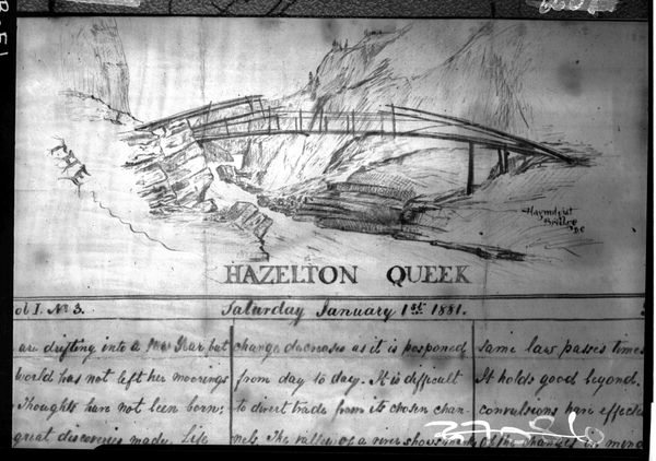
Without milled lumber, cement or steel, before giant drills and pile drivers, Indigenous people engineered spans as long as 150 feet across, hanging 50 feet above the swift and turbulent rivers below. (sketch probably H.K. Woods, 1898) 2/ 

This bridge over the Cranberry (Salmon) River was made by bending and tying poles with cedar withes (thin, flexible branches), looking a lot like in-stream fish traps built with the same materials. (1905 photo) 3/ 

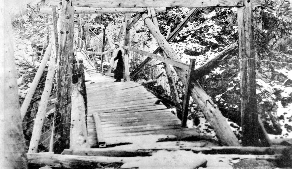
Some bridge construction will look more familiar, with short cross-wise timbers. This one, on the Suskwa River near Hazelton, was reinforced with telegraph wire in late 1800s, at the request of white men wanting to take pack animals across. 4/ 

Most bridges were built using the same ideas behind massive modern suspension bridges, with cantilevered spans balanced by rock & log ballast, fastened with withes & wood pegs. This bridge over the Babine River at Kisgagax was still in place in 1962. 5/ 

Probably the most famous span is the Hagwilget Bridge, which crossed the Bulkley River near Hazelton. Here's how it looked in 1872. 6/ 

The Hagwilget bridge was continually changing through time, as timbers were replaced. By the 1890s (L), a deck had been added. By 1910 (R), it had been reinforced with telegraph wire. 7/ 


The Hagwilget bridge both impressed and terrified the white men who used it. In 1919 Charles Morison wrote: “it was really a wonderful piece of work! but shaky and calculated to try the nerves of anyone crossing it for the first time”. Prob kept unwanted traffic down, tho. 7/ 


By the 1920s settlers tried to replace the Hagwilget Bridge with the new one in the distance (but it swayed so much it wasn't that popular either!) 8/ 

This pic of Hagwilget bridge is undated, but probably sometime after the 1920s. Most of the wood superstructure is replaced by wire, making it look even more frail. 9/ 

This smaller one across Beady Creek in Tahltan territory is a fav. You can see the tension in the poles when they were new (in 1900), and get why they'd have to be replaced. Often. 10/ 

One more: the bridge at Moricetown, 1905, was sturdy enough for livestock to cross (one of the major motivations behind using plank decking) 11/ 

There were likely hundreds of these ingenuous bridges around BC, constructed and maintained in strategic locations over the millennia. Little more than a few splinters and rotted logs remain, so these photos and sketches are an invaluable record. #archaeology #BCheritage 12/12 

*ingenius, faaaaahhk twitter get me an edit button
If you want to know more see Brenda Guernsey's detailed account via @RoyalBCMuseum (bit.ly/2ETjmkg), or just search @bcarchives' super easy online catalogue of pictures & documents. #beneathBC #bridges
• • •
Missing some Tweet in this thread? You can try to
force a refresh


