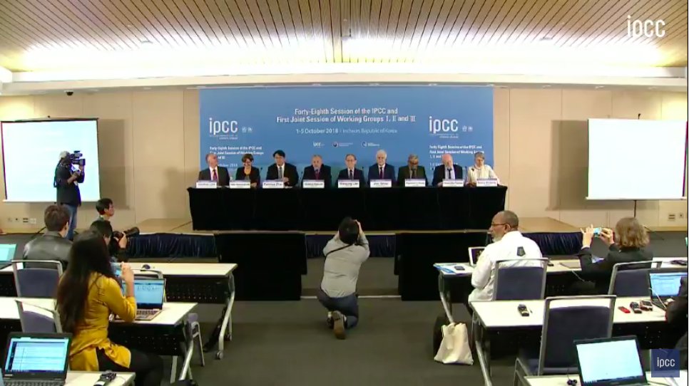
The day of the last big IPCC report—September 27, 2013—I gave up flying for good.
Today, I'm committing to courage.
The IPCC says we need to imagine and build an entirely different society between now and 2030, so I'm committing to my own personal 10-year plan to do just that.
That's a weird, nebulous goal -- but the task before us is weird and nebulous in part because it's difficult to imagine the world cooperating for something greater. We need images of that future. I'm going to help tell that story.
We've done it before. It's time to do it again.
Today's report is 1000 pages long, but there’s really just one main point to take away: Everyone and every idea is now a necessary part of the solution. We are all in this together.
I’ve said that before, sure, but it feels visceral now, in the hours since this report’s release.
Hurricane #Florence continues on track for a history-making landfall in North Carolina -- with potential simultaneous new all-time East Coast records for wind, rainfall, and storm surge.
OK you guys, my intention is not to scare anyone with this message.
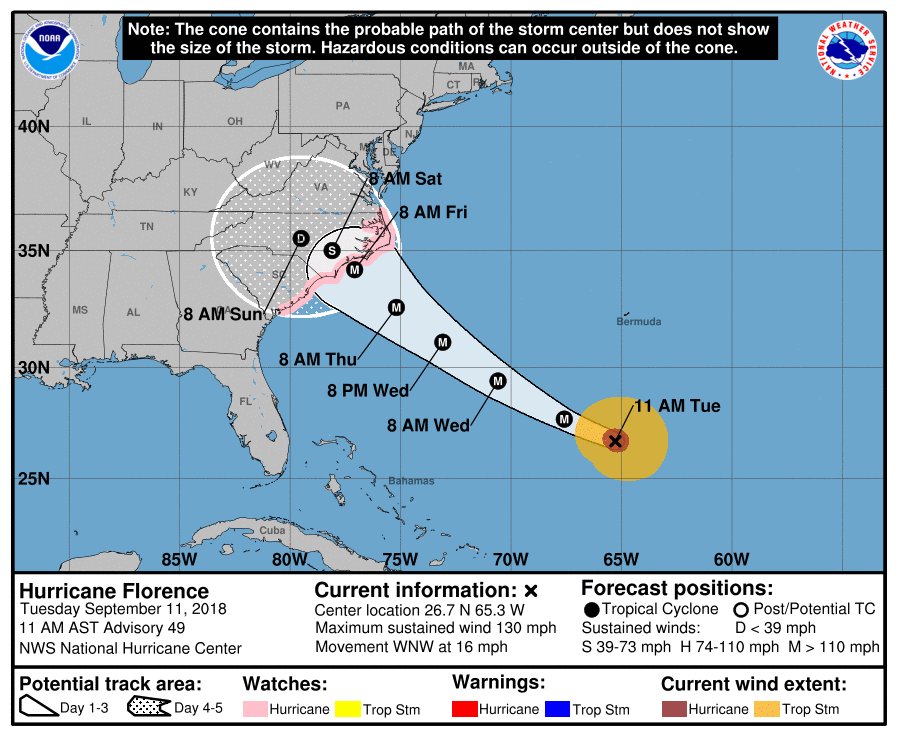
But Hurricane #Florence—the storm bound for North Carolina—is going to be about the size of North Carolina when it arrives.
This is what it will look like, according to the latest high-res model prediction:
And it will likely arrive as a Category 4 -- and potentially become the strongest East Coast hurricane landfall in recorded history, with sustained winds of >140mph.
Here's what that will do:
"Most of the area will be uninhabitable for weeks or months." nhc.noaa.gov/aboutsshws.php
*After* that, the latest weather models predict #Florence will stall out for four days -- similar to what happened to Hurricane Harvey last year in Texas.
Much of North Carolina & Virginia could be dealing with their worst flood in history.
Mid-day models continue to be unanimous: Florence is on track to landfall in the Carolinas on Thursday, likely as a Cat 4.
Longer-range models are still hinting at Florence stalling for 3+ days—creating a potentially catastrophic flood in NC/VA.
Where exactly #Florence makes landfall (and how far inland it goes after landfall) will determine the area most at risk of heavy rain and extreme inland flooding.
We're talking a multi-state region—potentially as far north as West Virginia, DC, Maryland, Delaware, Pennsylvania.
Hurricanes rotate counter-clockwise, so the northern edge of the storm is always rainier -- with air supplied straight from the ocean.
That's why Virginia is at a much greater risk of flooding right now than South Carolina.
Keep watch this storm—even if you're not in the cone.
Global energy-related CO2 emissions rose significantly in 2017—after a 3yr plateau that had many people openly wondering if we were turning a corner, peaking emissions more quickly than anyone thought plausible.
The world remains far off course to meet the Paris climate goals of 2°C warming—and striving to reach a rise of just 1.5°C
Doing so would require an immediate peak (and 1/3 global cut) by 2030.
Current policies and pledges will keep emissions rising until 2030 and beyond.
This isn't just a "oh, it would be nice to meet these goals"
Nope, climate change is a truly existential problem -- as in we won't have food, water, shelter for billions of people by the end of the century on the current course.